
Definition
Noun
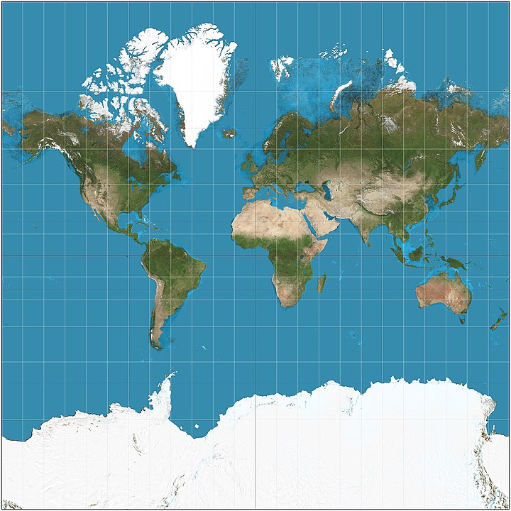
- A type of conformed projection used in charts and maps.
Origin
16th century. First published in 1569. Named for its conceiver, Gerardus Mercator, the Latinized name of Gerhardus Kremer. A noted Flemish scientist and cartographer.
Comments
This type of projection became the standard for maritime navigation by the mid-17th century. Since the vessel’s course and compass bearings (rhumb lines) could be drawn as a straight line it made navigation far easier to plot. One of the biggest issues with the Mercator projection is that it grossly distorts the size of landmasses at high latitudes. For example, Russia, Greenland, Antarctica, and Alaska are huge. Greenland is roughly the size of Africa, when in reality, Africa is 14 times larger. Antarctica is extremely large when in reality, it’s the third smallest continent. Alaska, Brazil, and Australia are roughly the same size. In reality, Australia and Brazil are about 4.5 and 5 times (respectively) the size of Alaska.
References
King, D., Hattendorf, J.B, & Estes, J.W. (1997). A Sea of Words: A Lexicon and Companion for Patrick O’Brian’s Seafaring Tales (2nd Ed.). Owl Books.
Rogers, J.G. (1985). Origins of Sea Terms. Mystic Seaport.
